Showing posts with label Bordered Area. Show all posts

Tuesday, May 3, 2016

The History For Baro-Bhuiyans Of Bengal


At the end of the Karrani Dynasty, the nobles of Bengal became fiercely independent. Sulaiman Khan Karrani carved out an independent principality in the Bhati region comprising a part of greater Dhaka district and parts of Mymensingh district. During that period Taj Khan Karrani and another Afghan chieftain who helped Isa Khan to obtain an estate in Sonargaon and Mymensingh in 1564. By winning the grace of the Afghan, chieftain, Isa Khan gradually increased his strength and status and by 1571 Mughal Court designated him as the ruler of Bhati.
Bhati region
Mughal histories, mainly the Akbarnama, the Ain-i-Akbari and the Baharistan-i-Ghaibi refers to the low-lying regions of Bengal as Bhati.
This region includes the Bhagirathi to the Meghna River is Bhati, while others include Hijli, Jessore, Chandradwip and Barisal Division in Bhati. Keeping in view the theatre of warfare between the Bara-Bhuiyans and the Mughals, the Baharistan-i-Ghaibi mentions the limits of the area bounded by the Ichamati River in the west, the Ganges in the south, the Tripura to the east; Alapsingh pargana (in present Mymensingh District) and Baniachang (in greater Sylhet) in the north. The Bara-Bhuiyans rose to power in this region and put up resistance to the Mughals, until Islam Khan Chisti made them submit in the reign of Jahangir.
Isa Khan
Isa Khan was the leader of the Baro Bhuiyans (twelve landlords) and a Zamindar of the Bhati region in medieval Bengal. Throughout his reign he put resistance against Mughal invasion. It was only after his death, when the region went totally under Mughals.
The Jesuit mission who sent to Bengal managed to identify that 3 of the chieftains were Hindus, they were Bakla of Bakarganj, Sripur of southeastern Dhaka (another source record the chief was Kedar Rai of Vikrampur), and Chandechan of Jessore while the rest were Muslims during Isa Khan's rule which in following decades N.K Bhattasali managed to identify some of them, which consisting:
  • Uthman of Bokainagar.
  • Ma'sum Khan Kabuli of Chatmogar in Pabna.
  • Madhu Ray of Khalsi.
  • Raja Ray of Shahzadpur in eastern Pabna.
  • the Ghazi Family in Bhowal on Dhaka which consisted Fazl Ghazi with his son and inheritor, Bahadhur Ghazi(who possessed large Naval fleets which was the main factor of Isa Khan's resistance against Mughal forces) along with Sona Ghazi and Anwar Ghazi.
  • Pahlawan of Matang in southwestern Sylhet
  • Nabud/Madan of Chandrapratap
  • Ram Chandra of Bakhla

The Located Shitalakkha River Of Narayangang

Narayanganj (Bengali: নারায়ণগঞ্জ Naraeongônj) is a city in central Bangladesh. It is located in the Narayanganj District, near the capital city of Dhaka and has a population of 220,000. The city is on the bank of the Shitalakshya River. The river port of Narayanganj is one of the oldest in Bangladesh.

Sunday, May 1, 2016

Administrative News Of Narayanganj Dist Town

Narayanganj district (Dhaka division) with an area of 759.57 sq km, is bounded by Gazipur and Narsingdi districts on the north, Brahmanbaria and Comilla districts on the east, Munshiganj district on the south, and Dhaka district on the west. Geologically, the area lies on the edge of the Madhupur tract and the Holocene floodplain deposits form the aquifer. The total area of the district is 759.57 sq km., of which 48.56 sq km. is reverine and 0.60 sq km. is under forest. The district lies between 23°33´and 23°57´north latitude and between 90°26´ and 90°45´ east longitude. Average maximum temperature 36°C, minimum 12.7°C; annual total rainfall 2376 mm. Physically the zila is characterised by alluvial formations caused by several rivers such as, Shitalakshya, Meghna, Old Brahmaputra, Buriganga, Balu and Dhaleshwari.

Narayanganj a former sub-divisional town of dhaka district upgraded to a district headquarter in February 1984. Narayanganj, the oldest and the most prominent river port of Bangladesh, grew into a place of trade and commerce and therefore, became known as a ganj. Vicon Lal Pandey (also known as Benur Thakur or Lakhsmi Narayan Thakur), a Hindu religious leader, acquired the ownership of this region from the East India Company in 1766. He declared the markets located on the bank of the river Shitalakshya as endowed property by a will to meet the expenses of the worship of Narayan and consequently, the place got the name Narayanganj.

Narayanganj subdivision was established in 1882 and was turned into a district in 1984. The district consists of five upazilas, 49 union parishads, 881 mouzas, 1374 villages, 2 municipalities, 12 wards and 115 mahallas. The upazilas are Araihazar, Bandar, Narayanganj sadar, Rupganj, and Sonargaon.

Narayanganj (Town) a municipal town (estd. in 1876), consists of 8 wards and 76 mahallas. The area of the town is 18.7 sq km. It has a population of 230294; male 53.51%, female 46.49%. The density of population is 12315 per sq km. The literacy rate among the town people 60.2%.

Narayanganj is connected to Dhaka by three metalled roads and a metre gauge rail line as well as by waterways through the rivers Buriganga and Shitalakshya. Steamer services from Narayanganj started in 1862. At that time, steamer and rail routes via Goalanda and Narayanganj connected Dhaka with calcutta. Narayanganj was then known more as the port of Dhaka. Narayanganj grew in importance after the arrival of the Portuguese and the English traders during the early parts of the 17th and 18th centuries respectively. Though the west bank of Shitalakshya was an important commercial centre since the rule of Mir Jumla in the early years of the second half of the 17th century. One of the important places of Narayanganj is Sonargaon, which had the distinction of being described by Ralph Fitch in 1583 as the place "where there is the best and finest cloth made of cotton that is in all India". Sonargaon is historically famous for manufacturing a species of very fine muslin. Narayanganj at times was known as the 'Dandy of the East.' National warehouse (silo-type), largest jute mill, cotton mills and a number of industrial units are located at Narayanganj. A major establishment of the Bangladesh Engineering and Ship Building Corporation established in 1925 at Sonakanda.

Archaeological heritage: Tomb of Sultan Giasuddin Azam Shah (1389-1411 AD), Baba Saleh Mosque (1481 AD), Goaldi Mosque (1519 AD), three domed mosque of Sultan Jalaluddin Fateh Shah (1484 AD), Hajiganj Fort, Sunakanda Fort, Pagla Bridge, Kadam Rasul Dargah, Bandar Shahi Mosque.

Historical events: Sonargaon of the district was an important historical place from the ancient time. It was the capital of Bengal during the reign of Isa khan.(see Sonargaon upazila HQ)

As of the 1991 Bangladesh census, Population 2138492; male 52.60% and female 47.40%; Muslim 92.59%, Hindu 6.43%, others 1.07%.

Religious institutions: Mosque 2006, temple 82, church 4, sacred place 4 and monastery 1.

Literacy rate and educational institutions: Average literacy 39.84%; male 46.23% and female 32.24%. Educational institutions: art college 1, physical education institute 1, marine technology centre 1. government. high school 2, non-government high school 127, madrasa 76, government. primary school 376, non-government primary school 47, kindergarten school 12, satellite school 24, community school 65, NGO operated school 285. The noted educational institutions are Narayanganj High School (1885), Tolaram College (1937) and Sonargaon J R institute (1900).

Cultural organisations Club 125, museum 1, public library 15, theatre group 15, literacy organisation 12, theatre spot 2, cinema hall 32, dakbungalow 6, shilpakala academy 1, shishu academy 1, community centre 8, Islamic foundation 1, mohila sangstha 2. Most reputed cultural institutions are the Folk Arts and Crafts Foundation at Sonargaon and Narayanganj Rifle Club.

Main occupations Agriculture 13.37%, agricultural labourer 8.61%, wage labourer 4.07%, commerce 19.9%, service 23.36%, weaving 5.49%, transport 4.09%, fishing 1.21%, industries 2.74%, construction 1.48%, others 15.68%.
Main crops Paddy, jute, wheat, mustard seed, vegetables

Fisheries, poultries and dairies Dairy 636, poultry 860, hatchery 4, nursery 31.

Communication facilities Roads: pucca 225.98 km, mud road 748 km; railway 18 km; waterways 111 nautical mile.

Manufactories: Adamjee Jute Mills (closed in 2002), Chittaranjan Cotton Mills, Lakshmi Narayan Cotton Mills, Dhakeshwari Mills, Star Particle Board Mills, Dhaka Vegetable Oil Mills, Husain Paper Mills, Moula Textile, RM Steel Mill, Haripur Electricity Centre, Hosiery Industries, Dying Mill, Aluminum Factory. Besides, Kachpur has become as an industrial town.

Cottage industries: Weaving is traditionally the most important cottage industry. Rupashi and Kazipara are famous for Jamdani sari production. Narayanganj is also famous for hosiery products.

Main exports: Fruits and fruit products, jute and jute products, jamdani saris and hosiery products.

NGO activities: brac, grameen bank, asa, proshika, SIDA.

Health centres: Hospital 4, upazila health complex 7, family welfare centre 34, union health centre 19, satellite health centre 4, clinic 12.
Nearby cities: Dhaka CityComilla District TownAgartala
Coordinates:   23°37'23"N   90°30'25"E

Historical Background Of Fakhruddin Mubarak Shah

Fakhruddin Mubarak Shah (Bengali: ফখরুদ্দিন মুবারক শাহ)(reigned: 1338–1349) ruled an independent kingdom in areas that lie within modern-day eastern and southeastern Bangladesh. He is also the first Muslim ruler to conquest Chittagong, the principal port of Bengal region in 1340 AD.
History
Fakhruddin's capital was Sonargaon. Sonargaon emerged as the principal city of the region as the capital of an independent sultanate during the reign of Fakhruddin Mubarak Shah. His conquests of Comilla and Noakhali were followed by territorial gains to the north Sylhet and south Chittagong. His military initiatives included a successful naval action against Sultan Alauddin Ali Shah of Lakhnauti. Shah sponsored several construction projects, including a trunk road and raised embankments, along with mosques and tombs. Ibn Batuta, after visiting his capital in 1346, described Shah as "a distinguished sovereign who loved strangers, particularly the fakirs and sufis.
He is credited to be the founder of independent Sultanate of Bengal, which lasted for about 200 years. His son Ikhtiyaruddin Ghazi Shah was his successor and ruled the independent Sultanate from Sonargaon till 1352.
Preceded by
Bahram Khan
Independent Sultan of Bengal
1338–1349
Succeeded by
Ikhtiyaruddin Ghazi Shah
See also
  • Sonargaon
  • Ibn Batuta
References
  1. Jump up to: Muazzam Hussain Khan, Fakhruddin Mubarak Shah, Banglapedia: The National Encyclopedia of Bangladesh, Asiatic Society of Bangladesh, Dhaka, Retrieved: 2011-04-23
  2. Jump up to: Sarkar, Jadunath (2003). The History of Bengal (Volume II): Muslim Period. Delhi: B.R. Publishing. ISBN 81-7646-239-X.
  3. Jump up^ "About Chittagong:History". Local Government Engineering Department, Government of Bangladesh.Retrieved: 2013-12-30
  4. Jump up^ Historical Sites needs to be preserved, The Daily Star, September 5, 2009,Retrieved: 2013-12-23
  5. Jump up^ Ibn Batuta, Famous Bengalis and Related Topics, Retrieved: 2013-12-23

Historical Importance Of Shitalakshya River


The Shitalakhya is a branch of the Brahmaputra which has changed its course at least twice in the Bangladesh region in the fairly recent past, indirectly affecting the flow of water in the Shitalakhya. In the 21st century, the main flow of the Brahmaputra waters is through the Jamuna channel. Earlier, after tracing a curve round the Garo Hills on the west, it took a sharp turn in the south-east direction near Dewanganj, and then passing by Jamalpur and Mymensingh, threw off the Shitalakhya branch and flowed through the eastern part of Dhaka district and fell into the Dhaleshwari. The Shitalakhya ran almost parallel to the Brahmaputra and after passing by Narayanganj joined the Dhaleswari. The course of the Brahmaputra through Dhaka district was deserted by the 18th century when it flowed further east and joined the Meghna near Bhairab. Towards the end of the 18th century the Jamuna channel increased its importance and around 1850 it became the main channel of the Brahmaputra.In Van den Brouck’s map the river is marked as Lecki, flowing west of Barrempooter (Brahmaputra). In Van den Brouck’s time (1660), it was large and swift flowing river. It was so till the early 19th century. There, however, are some reservations about the accuracy of Van den Brouck’s map.

Van den Brouck’s map of 1660
Historical importance
Sonargaon, a former capital of the region, stood on the banks of the Shitalakhhya. A fort was built by Isa Khan, a former ruler of the area, on its banks. It is believed that it was connected with Lalbagh Fort in Dhaka through an underground tunnel. Sonakanda Fort, also on the river, was built to counter Magh and Portuguese pirates. There are several historical mosques on its banks – Bandarshahi mosque (built in 1481 by Baba Saleh), Kadam Rasul mosque (containing the footprints of Hazrat Mohammad), Mariamer masjid (built by Shaista Khan) etc.
Economic importance
The Shitalakshya River was once an important center for the muslin industry. Even today, there are centres of artistic weaving on its banks. There also are a number of industrial units on its banks, including the Adamjee Jute Mills. Thermal power houses are located along the river at Palash (north of Ghorashal) and at Siddhirganj. Industrial affluent dumped into the river resulting in high levels of pollution is a cause for concern.

Portion of a sari woven on the banks of Shitalakshya River
There is a river port in Narayanganj. Numerous launches move out along the river to different parts of Bangladesh. The government has approved construction of a container terminal on the river Shitalakhya with foreign investment.
References
  1. Jump up to: Md Mahbub Murshed (2012). "Shitalakshya River". In Sirajul Islam and Ahmed A. Jamal. Banglapedia: National Encyclopedia of Bangladesh (Second ed.). Asiatic Society of Bangladesh.
  2. Jump up^ Majumdar, Dr. R.C., History of Ancient Bengal, First published 1971, Reprint 2005, pp. 3-4, Tulshi Prakashani, Kolkata, ISBN 81-89118-01-3.
  3. Jump up^ Roy, Niharranjan, Bangalir Itihas, Adi Parba(Bengali), first published 1972, reprint 2005, p. 86, Dey’s Publishing, 13 Bankim Chatterjee Street, Kolkata, ISBN 81-7079-270-3
  4. Jump up^ Khokon, Leaquat Hossain, 64 Jela Bhraman, 2007, pp.14-15, Anindya Prokash, Dhaka, ISBN 984-8740-19-8
  5. Jump up^ "Risk and Water Quality Assessment overview of River Sitalakhya in Bangladesh". Technical College, Bourgas. Retrieved 2007-11-22.
  6. Jump up^ UNB, Dhaka. "Govt okays container terminal on Shitalakhya". The Independent. Retrieved 2007-11-17.

Shitalakhya River Near Narayanganj

Shitalakshya River (Bengali: শীতলক্ষ্যা নদী pronounced: Shitalokkha Nodi) (also known as Lakhya River) is a distributary of the Brahmaputra. In its initial stages it flows in a southwest direction and then east of the city of Narayanganj in central Bangladesh until it merges with the Dhaleswari near Kalagachhiya. A portion of its upper course is known as Banar River. The river is about 110 kilometres (68 mi) long and at it widest, near Narayanganj, it is 300 metres (980 ft) across. Its flow, measured at Demra, has reached 74 cubic metres per second (2,600 cu ft/s). It remains navigable year round. The river flows through Gazipur district forming its border with Narsingdi for some distance and then through Narayanganj District.
The river's maximum depth is 21 metres (70 ft) and average depth is 10 metres (33 ft).

Once Upon A Time Military Campaigns Of Isa Khan


The ruling of Karrani dynasty ended when Daud Khan was defeated in the Battle of Rajmahal in 1576. Isa started playing a leading role in the local resistance. In the end he successfully conquered Dhaka, Rangpur, Pabna, Tripura, parts of Mymensingh and Bogra. In 1577, Isa established Egarasindhur (in present-day Pakundia Upazila,Kishoreganj) as the political and trading center. forming a petty kingdom that remained independent. He declared himself as the ruler of the Bhati region in 1581-82. From Sarail, he shifted his administrative centre to Sonargaon. He built fortresses at Katrabo, Kalagachhia and Khizrpur near Sonargaon.

Battle against Khan Jahan

In 1578 Mughal Subahdar of Bengal, Subahdar Khan Jahan led an expedition towards the Bhati region and set camp in Bhawal. Ibrahim Naral, Karimdad and Shah Bardi submitted their allegiance to the Mughal force. Isa faced the Mughal force led by Shah Bardi and Muhammad Quli on the Sarail-Juan Shahi border in Kastul on the bank ofMeghna river. According to Rajmala, Isa then quickly retreated to Tripura and sought assistance from the Tripura king, Amar Manikya. With the good grace of the queen Amrabati, the king granted an army of 52,000 to help Isa face the Mughals.
But before Isa returned to Sarail, two zamindars - Majlis Pratap and Majlis Dilawar already attacked and defeated the Mughal forces under Khan Jahan. Muhammad Quli was captured but Shah Bardi fled to Bhawal camp. With the remaining army, Khan Jahan retreated to Srihatpur city of Tandah. Few months later, Khan Jahan died of health issues on 19 December 1578.
According to descriptions by Rajmala, Khan, who became the Zamindar of Sarail, sent one thousand laborers for Amar Manikya along with other Zamindars of Bengal in response to the request made by Manikya to excavate the Amar Sagar Dighi at around 1580 AD. Besides, as the naval commander of Manikya, Khan fought against the Zamindar Taraf Fateh Khan in 1581 .

Battle against Shahbaz Khan

In 1583 Mughal General Shahbaz Khan destroyed Isa's palace in Baktiarpur. In September 1584, the then-subahdar Shahbaz crossed Ganges near Khizirpur and attacked Sonargaon, Katrabo and Egarasindhur. and pursued the defeated Pathan forces under Masum Kabuli up to Bikrampur in Dhaka, the cunning Isa then deluded negotiation of surrender and delayed the attack of Mughal general in several months. But in 1584 Isa and Masum Khan Kabuli deploying a muskets and gunpowder artilleries launched counterattack which finally defeat Shahbaz Khan in the naval and land battles of Egarasindur and Bhawal, and even killing one of Mughal general, then Shahbaz Khan retreated to Tandah.

Battle against Laksmana Singh Hajra

In 1585, he attacked two Koch rulers, Ram Hazra and Lakshman Hazra, and occupied their Jangalbari Fort (in present-day Karimganj Upazila, Kishoreganj ).
Another source from local tradition was recorded that this happened in 1586 after Man Singh had defeated him in the battle of Egarasindhur. In the same year, Mughal Subahdar Shahbaz Khan again sent his forces against Isa to the south.

Second battle against Shahbaz Khan

With the help of reinforcements by Emperor Akbar, Shahbaz Khan led another military expedition towards Bhati in 1586. Isa attacked him at Bhawal (north of Dhaka) but forces of Shahbaz Khan were well fortified near Brahmaputra. Isa then choose to give allegiance towards Akbar and prevented an imminent invasion of Bengal by the Mughals.
He even promised the Mughals he would dispatch Ma'sum Khan Kabuli, the renegade to a compulsory Pilgrimage to Mecca, something that viewed as an act of banishment. and although in the end he didn't do it, he did manage to restrain the rebel.
In late 1586 Ralph Fitch, an English traveler and merchant, came to Sonargaon, Bengal’s eastern districts and stated,
They be all hereabout Rebels against the King Zebaldin Echebar [ Jalaluddin Akbar ]: for here are so many Rivers and Ilands, that they flee from one to another, whereby his Horsemen cannot prevaile against them. The chief King of all these Countries is called Isacan [Isa Khan], and he is chief of all the other Kings, and is a great friend to all Christians.
Later on in 1588 he was involved in conflicts against Chand Rai and Kedar Rai

Battle against Raghudev

Isa continued his campaign against the Koch Kingdom. this time he fight and defeat Raghudev the king of Koch Hajo who ruled from Sankosh river in the west to the Bhareli riverin the east on the north bank of the Brahmaputra river and rival to Koch Bihar kingdom which gained prominence after the latter's annexation by Mughal empire. Isa successfully captured portions of Raghudev's territory as far as Rangamati and Goalpara. However, later Isa Khan and Raghudev formed an alliance against the threat of Mughal invasion

Battle against Durjan Singh

On 17 March 1594 Man Singh was appointed the Subahdar of Bengal by Emperor Akbar. After establishing Rajmahal as the capital of Bengal, Man Singh sent his own son, Durjan Singh, to Isa's Bhati region with a vast army on 7 December 1595. Isa was emboldened to resist the Mughals after he successfully sought alliance with Raghudev, his former enemy and Kedar Rai, Zamindar of Bhusna in Faridpur. In the clash that took in August 1597 and Isa engaged in a battle against Mughal naval forces with the assistance of Masum Khan Kabuli, an ex-Mughal defector. At first Isa faced defeat with the Mughals attacking Katrabo, one of Isa's pargana and city. However, on 5 September Durjan Singh was killed and Mughal was defeated. Both the army and navy of the Mughal-Koch Bihar alliance were either routed or captured.
It is recorded that in this clash Isa personally fought Man Sing in a duel. However the duel ended inconclusively when Isa Khan stopped fighting after Man Singh’s sword broke. The noble gesture touched Man Singh and both men was found respect for each other which developed into a friendship. Man Singh respect to his rival was even further that later when Isa sought to submit to the Mughal as the latter thought its wiser not to incite a full invasion, Man Singh accompany him to the Mughal court.

Saturday, April 30, 2016

Sub-Office List Of Narayanganj District

Bangladesh Post office is a govt. owned department dedicated to provide wide range of postal products and public services. It is the premier national postal communication service holding together a vast country with a large population. Bangladesh Post Office is committed to provide a speedy, reliable and regular service to the people of all walks of life at a reasonable cost.

Whats Going On In Marine Sector Of Bangladesh


Sunday, April 24, 2016

District Liberation War of Map

Sectors The War Of Liberation

War of Liberation, The began on 26 March 1971 and ended with the liberation of Bangladesh on 16 December 1971. The armed struggle was the culmination of a series of events, situations and issues contributing to the progressively deteriorating relations between East and West Pakistan. The questions of land reforms, state language, inter-wing economic and administrative disparities, provincial autonomy, the defense of East Pakistan and many other consequential questions had been straining the relations between the two wings of Pakistan ever since independence of the country from Britain in 1947.
The general elections of 1970 had made Bangabandhu sheikh mujibur rahman, chief of awami league which bagged 167 seats out of 169, the sole spokesman of the people of East Pakistan and majority leader in the Pakistan National Assembly. But the Pakistan civil and military ruling clique had refused to transfer power to the majority leader Sheikh Mujibur Rahman and his party. Sheikh Mujib also refused to yield to the pressure put on him for undue accommodation. Sheikh Mujib's historic address on 7 March 1971 made this point quite clear to the Pakistani military junta. Then began the civil disobedience movement. Meanwhile talks started between Sheikh Mujib and President Yahya Khan to resolve the outstanding issues.
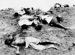
While holding talks, the Pakistani military junta was bringing more troops to Bangladesh, and at the same time wantonly killing innocent civilians all over the country. This clearly showed that they were totally insincere about handing over power to the elected representatives of East Pakistan. No sooner the talks failed, the genocide began with the Pakistan army's crackdown on the people of East Pakistan on the midnight of 25 March 1971. The Bangali soldiers serving in the then Pakistan Armed Forces and para militia forces declared instantly their solidarity with the people's liberation war.
Genocide, 1971
The Pakistan Army was ordered to launch operation on Bangali people at midnight of 25 March. According to the plan for operation Search Light two headquarters were established. Major General Rao Farman Ali with 57 Brigade under Brigedier Arbab was responsible for operation in Dhaka city and its suburbs while Major General Khadim Raja was given the responsibility of the rest of the province. Lieutenant General Tikka Khan assumed the overall charge of the operation.
Sector 2 comprised of the districts of Dhaka, Comilla, and Faridpur, and part of Noakhali district. This sector was raised from the nucleus of 4 East Bengal and the EPR troops of Comilla and Noakhali. The sector was located at Melaghar about 20 miles south of Agartala. The sector commander was Major Khaled Mosharraf, later replaced by Major ATM Haider. About thirty five thousand guerilla fighters fought in this sector. Nearly six thousand of them were members of regular armed forces. The six sub-sectors of this sector (and their commanders) were: Gangasagar, Akhaura and Kasba (Mahbub, later replaced by Lieutenant Farooq, and Lieutenant Humayun Kabir); Mandabhav (Captain Gaffar); Shalda-nadi (Abdus Saleq Chowdhury); Matinagar (Lieutenant Didarul Alam); Nirbhoypur (Captain Akbar, later replaced by Lieutant Mahbub); and Rajnagar (Captain Jafar Imam, later replaced by Captain Shahid, and Lieutenant Imamuzzaman). Due to the operations of this sector the Dhaka-Chittagong highway in between Comilla and Feni was denied to the Pakistanis throughout the nine months of war of liberation. One of the most successful operations of this sector was the defence of the Belonia Bulge. The entries Belonia Bulge was kept liberated by the combined forces of 1 and 2 sectors till 21 June. In this sector, a number of regular companies operated deep inside Bangladesh. These were the Noakhali Company under subeder Lutfar Rahman operating around Begumganj, the Chandpur Company under subeder Zahirul Alam Khan operating in Chandpur Matlab area, a large force under Captain Abdul Halim Chowdhury operating in Manikganj-Munshiganj area in Dhaka and a force under Captain Shawkat at Faridpur. The urban guerrillas carried out a number of successful operations in Dhaka city itself.

Information Of Narayanganj District

Narayanganj District (dhaka division) area 687.76 sq km located in between 23°33' and 23°57' north latitudes and in between 90°26' and 90°45' east longitudes. It is bounded by narsingdi and gazipur districts on the north, munshiganj district on the south, brahmanbaria and comilla districts on the east,dhaka district on the west.
Population Total 2173948; male 1161971, female 1011977; Muslim 2057398, Hindu 115151, Buddhist 695, Christian 385 and others 319.
Water bodies Main rivers: shitalakshya, meghna, old brahmaputra, buriganga, balu, dhaleshwari.
Administration Narayanganj Sub-division was formed in 1882 and it was turned into' distict in 1984. Of the five upazilas of the district araihazar is the largest (183.35sq km) and bandar is the smallest (55.84 sq km). narayanganj city corporation was established on 5 May 2011.
Profile
Narayanganj subdivision was established in 1882 and was turned into a district in 1984. The district consists of five upazilas, 49 union parishads, 881 mouzas, 1374 villages, 2 municipalities, 12 wards and 115 mahallas.
Area759.57 square kilometers.
Bounded by
Narsingdi and Gazipur districts on the north, Munshiganj districts on the south, Brahmanbaria and Comilla districts on the east, Dhaka districts on the west.
History
sonargaon of the district was an important historical place from the ancient time. It was the capital of Bengal during the reign of isa khan. During the War of Liberation, the Pak army killed 139 people in Fatullah Thana on 29 November 1971.
Places to see
sonargaon of the district was an important historical place from the ancient time. It was the capital of Bengal during the reign of isa khan. During the War of Liberation, the Pak army killed 139 people in Fatullah Thana on 29 November 1971.
Newspapers
The Daily Sitalakhya, Khaborer Pata; weekly Fair House; extinct: weekly Sakal Barta, Ganadak.

Parliament Election And Elected MP(s) in Narayanganj District

Upazilla/ Thana
Araihazar Upazila, Bandar Upazila, Narayanganj Sadar Upazila, Rupganj Upazila, Sonargaon Upazila

Thursday, April 21, 2016

Details Araihazar Upazila of Narayanganj District

Araihazar (Bengaliআড়াইহাজার) is an Upazila of Narayanganj District in the Division of Dhaka  Bangladesh.Araihazar is located at 23.7917°N 90.6500°E . It has 52963 households and total area 183.35 km².Araihazar has 2 Municipality (Araihazar & Gopaldi), 10 Unions, 108 Wards, 184 Mauzas/Mahallas, and 316 villages. Araihazar consists of both plain lands and Haor areas, not only self-sufficient in food and fish but also famous for powerloomspinning millssizing mills & fabrics.

Population Census Of Sonargaon Upazila

Sonargaon (Bengaliসোনারগাঁও) is an Upazila of Narayanganj District in the Division of DhakaBangladesh.Sonargaon is located at 23.6583°N 90.6083°E . It has 44405 households and total area 171.66 km2.As of the 1991 Bangladesh census, Sonargaon has a population of 261881. Males constitute 52.11% of the population, and females 47.89%. This Upazila's eighteen up population is 118319. SonargaSonargaon has 11 Unions/Wards, 354 Mauzas/Mahallas, and 473 villages.on has an average literacy rate of 33.1% (7+ years), and the national average of 32.4% literate.Local food includes Gurer ZilapiMuraliBinni KhoiShwandesh, etc.

Overall Information Of Bandar Upazila In Narayanganj District

Bandar (Bengaliবন্দর) is an Upazila of Narayanganj District in the Division of Dhaka ,
Bangladesh.Bandar is located at 23°35′35″N 090°31′13″E . It has 38985 households and total area 55.84 km².As of the 1991 Bangladesh census, Bandar has a population of 212572. Males constitute 52.47% of the population, and females 47.53%. This Upazila's eighteen up population is 109270. Bandar has an average literacy rate of 44.1% (7+ years), and the national average of 32.4% literate.Bandar has 9 Unions/Wards, 122 Madangonj m/Mahallas, and 183 villages.

Narayanganj Sadar Upazila Of Narayanganj District Information

Narayanganj Sadar (Bengaliনারায়নগঞ্জ) is an Upazila of Narayanganj District in the Division of DhakaBangladesh.Narayanganj Sadar is located at 23.6000°N 90.5000°E . It has 113635 households and total area 100.75 km². Narayanganj Sadar has 18 Unions/Wards, 149 Mauzas/Mahallas, and 132 villages.
Administration
Chairman : Abul Kalam Azad Bish-shash (from Awami League) [1]
Woman Vice Chairman : Ms Fatema Monir (from Awami League) [2]
Vice Chairman : Nazim Uddin (from Awami League)
Upazila Nirbahi Officer (UNO) : Md.Gausul Azam(http://jugantor.us/enews/issue/2012/09/11/news0913.htm] [3]

Basic Information Of Narayanganj District

Narayanganj District (Bengaliনারায়ণগঞ্জ জেলা pronounced: Naraeongônj Jela) is a district in central Bangladesh, part of the Dhaka Division.The main city of the district is Narayanganj. It is near the capital city of Dhaka. The river port of Narayanganj is one of the oldest in Bangladesh. It is also a center of business and industry, especially the jute trade and processing plants, and the textile sector of the country. It is nicknamed the Dundee of Bangladesh due to the presence of many jute millsDundee was the first industrialised "Juteopolis" in the world.